


Basics
- Location:
- Near Steamboat Springs
- Setting:
- Mountainous
- Length:
- 22.4 miles oneway
- Difficulty:
- Intermediate
- Time:
- 11.5 to 13.5 hours
- Trailhead Elevation:
- 8400 feet
- Season:
- Summer - Early Fall
Description
Trail #1100
Please note that this trail does allow bicycling however NOT once you've reached the Mount Zirkel Wilderness. No bicycles are allowed in designated wilderness areas! This is a great cross country ski trail at the lower elevations which has a longer season of use than most high country trails. This is one of the few trails that cross three major drainages coming from the Continental Divide (Elk River, Big Creek, and Mad Creek). The trail has some boggy areas in it. The trail also serves as a trunk trail to the Red Dirt trail #1171, Luna Lake trail #1168, and Roaring Fork trail #1166.
The Swamp Park Trail leaves the South Fork Road #443 and follows the South Fork of the Elk River downstream before turning up Burn Creek and on to Burn Ridge. The trail then switchbacks into and out of Big Creek, then on to Swamp Park. Two miles south of Swamp Park the user has the choice of taking Red Dirt trail #1171 ending into Elk River Road (CR 129) or continuing on #1100. If the user continues on #1100, the trail will again split. If continuing on #1100, the user will travel down into the Mad Creek TH. If the user turns left onto Elk Park #1118, this trail will end at the 4WD road #314 in Elk Park.
Tour Companies
Vista Verde Guest Ranch - Hiking
- Near Steamboat Springs
- Hiking
- 970-879-3858
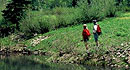 At Vista Verde Ranch, hiking is one of the many activities you can try during your all-inclusive Colorado ranch vacation. Our guides offer a customized outdoor experience whether you want to rock climb, mountain bike, fly fish or horseback ride.
Helpful Links
Tour Companies
Vista Verde Guest Ranch - Hiking
- Near Steamboat Springs
- Hiking
- 970-879-3858
Details
Location:
Setting:
Length:
Difficulty:
Time:
Trailhead Elevation:
Season:
Useful Map(s):
Map + Directions
Basic Directions
1)Go west of Steamboat Springs on US HWY 40 about 2 miles, and turn north on Elk River Road (CR 129) for about 15 miles. Just past Clark, turn right on to Seedhouse Road (FDR 400) and travel 12 miles. Turn right at the fork on to South Fork Road (FDR 443) & travel about 2.5 miles to the TH on the right.
2)Go north of Steamboat Springs on Strawberry Park Road for about 4.5 miles to the Elk Park Road, #314 (may be unmarked). Turn right on this 4WD road and travel 4 miles to its end where you will find the Elk Park TH #1118 (This trail will connect with 1100).


