


Basics
- Location:
- 45 miles northwest of Vail
- Setting:
- Mountainous
- Length:
- 10 mile roundtrip
- Time:
- 5 to 6 hours
- Trailhead Elevation:
- 8150 feet
- Elevation Change:
- 2850 feet
- Season:
- April - October
Description
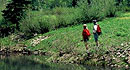
King Mountain trail climbs along ridge above from Highway 131 near Egeria Creek, from open sagebrush and grassland to pine and aspen forest. The scenery is outstanding, with broad panoramas, and wildlife-watching opportunities are excellent. Fishing is available.
Use limited to hiking, mountain biking, and horseback riding; motorized vehicles are prohibited.
Tour Companies
Vista Verde Guest Ranch - Hiking
- Near Steamboat Springs
- Hiking
- 970-879-3858
 At Vista Verde Ranch, hiking is one of the many activities you can try during your all-inclusive Colorado ranch vacation. Our guides offer a customized outdoor experience whether you want to rock climb, mountain bike, fly fish or horseback ride.
Helpful Links
Tour Companies
Vista Verde Guest Ranch - Hiking
- Near Steamboat Springs
- Hiking
- 970-879-3858
Details
Location:
45 miles northwest of Vail
Setting:
Mountainous
Length:
10 mile roundtrip
Time:
5 to 6 hours
Trailhead Elevation:
8150
Elevation Change:
2850
Season:
April - October
Useful Map(s):
USGS 1: 24,000 quads: Blue Hill, Toponas, Trapper,
Map + Directions
Basic Directions
From I-70 at Wolcott drive north on Colorado Highway 131 approximately 31 miles to trailhead on the west side.


