Colorado Map

Request Free Visitor Guides

Missouri National Recreational River

Contact Info
508 East 2nd Street
Yankton, SD 57078

Phone:
605-665-0209
Basics
Type:
National Park

Description

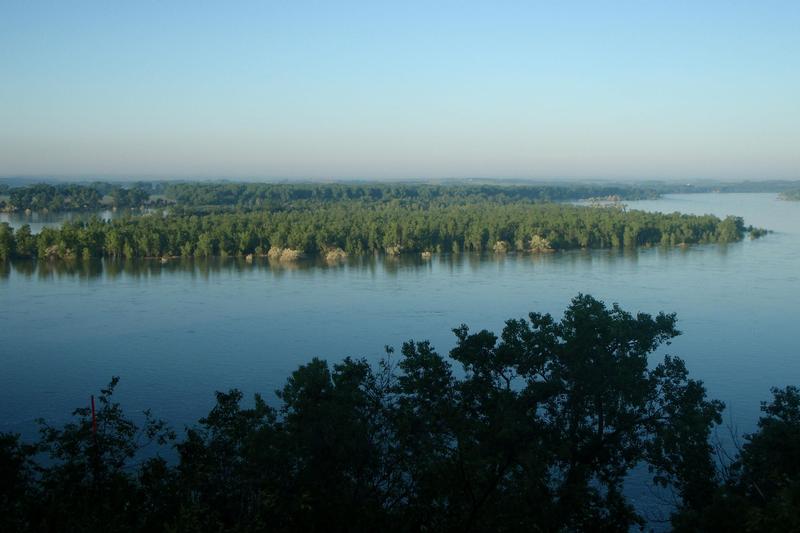
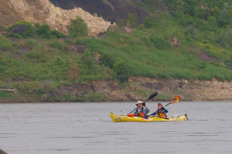
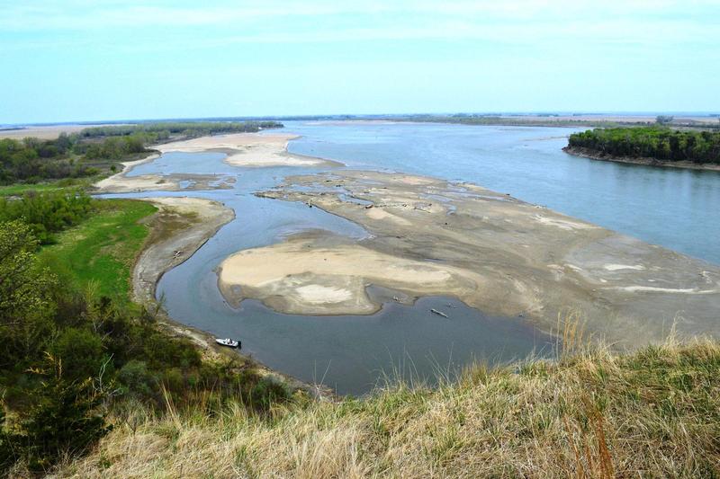
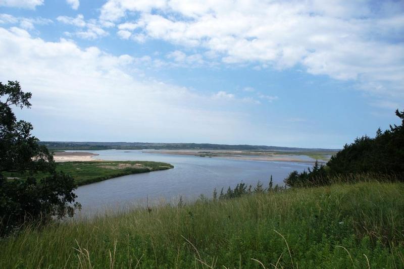
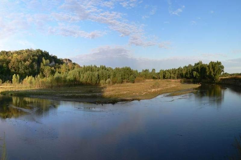
The Missouri has a history like no other river. Explore the great waterway of American Indians, fur trappers, Lewis and Clark, and many others. Experience the dynamic character of the river's ever-changing nature. View the natural beauty of the "rec river" along 100 miles of the Nebraska-South Dakota border. Listen for the eerie screech of the majestic bald eagle or the splash of a trophy fish.

Hours + Fees

Hours:

Lewis & Clark Visitor Center
Operated by the Army Corps of Engineers, this visitor center includes exhibits and includes exhibits and information on the Missouri River basin. It is located on Calumet Bluff just downstream from the Gavins Point Dam in Nebraska. To get there take Nebraska Highway 121, about 4 miles west of Yankton, South Dakota. Hours of Operation: Open 7 days a week: 9:00 a.m. to 5:00 p.m. during the warm season; Monday through Friday from 8:00 a.m. to 4:00 p.m. October through February. Closed on Federal holidays. Call 402-667-2546 for information.

Mulberry Bend Overlook
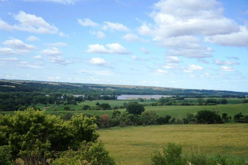
With a great view of the 59-mile reach of the river, this overlook is on the Nebraska side by the Newcastle-Vermillion (Missouri River) Bridge connecting Vermillion, South Dakota, and Newcastle, Nebraska (SD 19 and Nebraska 15). It is open year-round and may be closed in winter when conditions warrant. Wayside exhibits at the parking area tell the story of the Lewis and Clark Expedition and the historic river. A short hike to the top affords a panoramic vista of the wild and scenic Missouri.

Missouri National Recreational River Resource & Education Center
The building is located in Nebraska's Ponca State Park and houses a large exhibit wing featuring the wild and scenic Missouri River and the Missouri National Recreational River. It is open Monday through Saturday from 8:00 a.m. to 5:00 p.m. and on Sunday from 1:00 p.m. to 5:00 p.m. Hours are extended during the summer. The state park is at the end of Highway Spur 26 E about three miles north of Ponca. A valid daily or annual entry permit is required. To learn more call: 402-755-2284.

Price Details:

There are no fees to enter Missouri National Recreational River or the Lewis and Clark Visitor Center adjacent to Gavins Point Dam. However, our state park partners do charge.

Map + Directions

Basic Directions

Directions to Park Headquarters
Located at 508 East Second Street in Yankton
- From US Highway 81 in Nebraska: Cross the bridge into South Dakota and take the first right onto Second Street. Go east about 5 blocks; the office will be on your left.
- From US Highway 81 in South Dakota: Go through Yankton and take the last left turn before the bridge (2nd St.). Go east about 5 blocks; the office will be on your left.
- From US Highway 50 west of Yankton: Turn right on Highway 81, go through Yankton and take the last left turn before the bridge (2nd St.). Go east about 5 blocks; the office will be on your left.
- From US Highway 50 East of Yankton: Turn left at the first stoplight (Burleigh/Second St.) The park office is the first building on the right.

Directions to the Lewis and Clark Visitor Center
This is one of the the main public contact points for the park.
Located at 55245 Nebraska Highway 121, Crofton, NE 68730

- From US 81 in South Dakota: Cross the Missouri River on US 81 South. After 2 miles turn right (heading west) onto Nebraska Route 121. Continue on 121, following it to the left after 4 miles and drive to the top of the hill. The visitor center parking lot entrance is on the right. Or
- From US 81 in Nebraska: Drive north on US 81 toward Yankton. Turn left onto Nebraska Route 121, following it to the left after 4 miles and drive to the top of the hill. The visitor center parking lot entrance is on the right.
- From Yankton: Take South Dakota Route 52 west from Yankton six miles to the road that crosses the dam (Crest Road). Turn left onto the Crest Road (heading south). Follow this road across the dam and take the first road to the right, Nebraska Route 121. Turn right and drive up the hill. The visitor center parking lot entrance is on the right.

Directions to the Fort Randall Visitor Center
This center provides an excellent view of the Missouri River and Fort Randall Dam.
Located near Pickstown, S.D., River Mile 880.0

- From US 46 in South Dakota: After leaving Wagner, S.D., drive 16 miles west, turn right at Fort Randall Visitor Center, just on the east side of Fort Randall Dam. Or
- From US 18 and 46 in South Dakota: Driving east on US 18 from Bonesteel, S.D. for 29 miles cross Fort Randall Dam onto US 46. Take the first left after crossing the dam to the Fort Randall Visitor Center.

Customizable Directions

Colorado Norfolk ChaffeeCounty-skyscraper

Copyright © 1997 - 2024 The Go Travel Sites. All Rights Reserved and.

Email Page Link

Complete the form below to email this page to a friend or family member's email. You can send yourself an email as well. Your email and your recipient's email will NOT be shared with anyone. See our full Privacy Policy for details.
:
:
:


:
Copy Yourself on the Email Yes No
:
:

1

Select one or more Free Visitor Guides below

2

Complete the form to receive your guides by mail
Chaffee County Chaffee County Chaffee County
Central ColoradoMore than 100 miles of the Arkansas River and her tributaries flow through the heart of Chaffee County, gracing both Salida and Buena Vista with her beauty and world-renowned whitewater, fly-fishing, scenery and river festivals.
Request this Free Visitor GuideRequested! You're all set! Request a few more Visitor Guides, or complete the form below to receive your guides by mail.
Colorado Springs Colorado Springs Colorado Springs
Central ColoradoFind yourself in Colorado Springs at Pikes Peak. We have five historic trains to transport you back to the days of cowboys and gold mining. Endless trails allow you to enjoy the abundant sunshine and spectacular scenery. A family vacation in Colorado Springs is the smart choice – great lodging values, a long list of low-cost or no-cost activities, and adventure around every corner. Order your free guide today.
Request this Free Visitor GuideRequested! You're all set! Request a few more Visitor Guides, or complete the form below to receive your guides by mail.
Grand Lake Grand Lake Grand Lake
Rocky Mountain National ParkAt the edge of Rocky Mountain National Park, Grand Lake is the deepest natural lake in Colorado, dipping to 265 feet. Fed by high mountain runoff, the lake is clear and pristine. In the summer, you can rent a boat, bring your own or simply enjoy the gentle lapping of the waves from the sandy shore. Grand Lake connects with Shadow Mountain Lake via a canal, and just down the road is Lake Granby, the second largest body of water in Colorado.
Request this Free Visitor GuideRequested! You're all set! Request a few more Visitor Guides, or complete the form below to receive your guides by mail.
Red River Red River Red River
Northern New MexicoRed River, New Mexico! A place where fresh powder winters meet refreshing summer days. Red River offers something for everyone with its convenient scenic location in the heart of Northern New Mexico’s Enchanted Circle. Red River is the place that awakens us each day by the soothing sound of a rushing river and then again each evening as the sun sets over main street. The mountain town of Red River is New Mexico True.
Request this Free Visitor GuideRequested! You're all set! Request a few more Visitor Guides, or complete the form below to receive your guides by mail.
Farmington Farmington Farmington
Northwestern New MexicoNorthwestern New Mexico is known by many as a magical place. Four Corners and the local Aztec Ruins are considered sacred ground for some and are fascinating to visit.
Request this Free Visitor GuideRequested! You're all set! Request a few more Visitor Guides, or complete the form below to receive your guides by mail.
South Fork South Fork South Fork
Southwestern ColoradoAre you looking for a naturalist paradise with affordability? Then look no further South Fork is your destination. A world class golf course, gold medal fishing in the Rio Grande, and thousands of acres of National Forest to hike, bike, ATV, ski and snowmobile through.
Request this Free Visitor GuideRequested! You're all set! Request a few more Visitor Guides, or complete the form below to receive your guides by mail.
Palisade, Colorado Palisade, Colorado Palisade, Colorado
WesternLife Tastes Good Here all Year Long!
Request this Free Visitor GuideRequested! You're all set! Request a few more Visitor Guides, or complete the form below to receive your guides by mail.
Visit Moffat County Visit Moffat County Visit Moffat County
Northwestern ColoradoWelcome to Colorado’s Great Northwest, Moffat County has nearly 2 million acres of public lands to explore. Experience places like Dinosaur National Monument, the Sand Wash Basin Wild Horse Management Area and free flowing rivers including the mighty Yampa, last of the wild ones!
Request this Free Visitor GuideRequested! You're all set! Request a few more Visitor Guides, or complete the form below to receive your guides by mail.
Ski Utah Ski Utah Ski Utah
Utah
Request this Free Visitor GuideRequested! You're all set! Request a few more Visitor Guides, or complete the form below to receive your guides by mail.