


Basics
- Location:
- Near Steamboat Springs
- Setting:
- Mountainous
- Length:
- 18.4 mile roundtrip
- Difficulty:
- Intermediate,
Difficult
- Time:
- 9.5 to 11 hours
- Trailhead Elevation:
- 9100 feet
- Elevation Change:
- -2000 feet
- Season:
- Summer
Description
Trail #1168
There is adequate parking near Summit Lake Campground, please park in the parking lots provided, help protect the vegetation. This trail has some rough and steep spots along the way. NOTE: ALWAYS BE WATCHFUL FOR STORMS (HAIL) IN THESE HIGH AREAS. BE PREPARED FOR INCLEMENT WEATHER AT ALL TIMES.
The trail takes the hiker by many lakes. From Swamp Park one travels up and through wooded and rocky areas coming out into Logan Park, then on past Lake Margaret (a good side trip is to go down to Snowstorm Lake and Fish Hawk Lake; however the trail is unimproved). Continue on through the forest and before reaching Luna Lake, a trail takes off north to Big Creek Lake. This is also a good side trip for fisherman. As you reach Luna Lake, the trees thin out and you can see up to Mt. Ethel and the Divide. Luna is a beautiful lake with a sand beach, however, the water stays very cold. From Luna you can continue up to Lake Elbert (very difficult, rocky). Then follow the trail off the Divide to Lake of the Crags, and return downhill to Luna Lake. There are breathtaking views from there.
Tour Companies
Vista Verde Guest Ranch - Hiking
- Near Steamboat Springs
- Hiking
- 970-879-3858
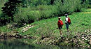 At Vista Verde Ranch, hiking is one of the many activities you can try during your all-inclusive Colorado ranch vacation. Our guides offer a customized outdoor experience whether you want to rock climb, mountain bike, fly fish or horseback ride.
Helpful Links
Tour Companies
Vista Verde Guest Ranch - Hiking
- Near Steamboat Springs
- Hiking
- 970-879-3858
Details
Location:
Setting:
Length:
Difficulty:
Difficult
Time:
Trailhead Elevation:
Elevation Change:
Season:
Useful Map(s):
Map + Directions
Basic Directions
1)Go west of Steamboat Springs on U.S. 40 for about 2 miles to the Elk River Road (airport) turn off. Travel on this road approximately 5 miles to Mad Creek and park in the lot behind the buck and rail fence. Hike about 7 miles into Swamp Park
2)Go north of Steamboat on the Strawberry Park Road to County Road #60 (Buffalo Pass Road) and turn right. Travel approximately 9 miles on this road to Summit Lake Campground and the Mt. Zirkel Wilderness boundary trailhead. Walk the Wyoming Trail #1101 about 6 miles to the junction of trail #1168.


