


Basics
- Location:
- Near Steamboat Springs
- Setting:
- Mountainous
- Length:
- 2.8 mile roundtrip
- Difficulty:
- Intermediate,
Difficult
- Time:
- 1.5 hours
- Trailhead Elevation:
- 9400 feet
- Elevation Change:
- -1400 feet
- Season:
- Spring - Fall
Basic Directions
Drive west out of Steamboat Springs for 2 miles and turn right on to Elk River Road (CR 129). Drive 29 miles to the old settlement of Columbine. With the General Store on your left, turn right onto the dirt jeep road, FDR 490. At this point, private property needs to be respected. Drive 1.8 miles down FDR 490 and it will fork, turn left. After 0.2 miles it forks again, again turn left and park.
Description
Trail #1158
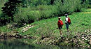
Views of Hahns Peak's 10,839 foot summit make a drive to the Steamboat Lake area rewarding. The summit is an easier hike than it would first appear. You'll be treated to spectacular 360 o views of the Routt National Forest and the Mount Zirkel Wilderness Area, as well as north all the way into Wyoming. You can also explore boulder fields for rock crystals and discover a great variety of wildflowers/berries, as well. Please respect the trail. It actually is private property open only to foot travel. NOTE: Start the hike early in the morning to avoid afternoon electrical storms, and avoid the top at all costs if storm clouds move into the area or if you see lightning even in the distance.
You will notice that the trail is an old jeep trail. Once the user has begun the hike, the trail will shortly split; one trail heading left and downward, the other to the right (straight) and elevating. Turn right at this junction. After traveling a short distance, on the right a hiking trail veers off of the jeep road. This is the 1158 trail that will take the user to the top of Hahns Peak. Once through the forested area, the trail consists of loose rock, volcanic rock. Be careful not to slip or send rocks tumbling downhill! At the peak, an old fire lookout tower sits having been constructed in 1912 and reconstructed in 1942. It has not officially been used since the 1950's and it is listed on the Colorado Inventory of Historical Places.
Tour Companies
Vista Verde Guest Ranch - Hiking
- Near Steamboat Springs
- Hiking
- 970-879-3858
 At Vista Verde Ranch, hiking is one of the many activities you can try during your all-inclusive Colorado ranch vacation. Our guides offer a customized outdoor experience whether you want to rock climb, mountain bike, fly fish or horseback ride.
Helpful Links
Tour Companies
Vista Verde Guest Ranch - Hiking
- Near Steamboat Springs
- Hiking
- 970-879-3858
Details
Location:
Setting:
Length:
Difficulty:
Difficult


