The prettiest part of the Dog Lake loop is probably the first two miles of the hike, along Butler Fork. Butler Fork meanders northward through a narrow canyon filled with dense groves of quaking aspen, eventually emerging into a more open forest of Engelmann spruce and Douglas fir along the ridge above Mill Creek Canyon. It is not uncommon to see moose along this part of the trail. Look for their hoof tracks along the path-similar to deer tracks, but two to three times larger.
The Lake itself is located in a shallow, heavily forested basin just south of the ridge that separates Mill Creek Canyon from Big Cottonwood Canyon.
Although Dog Lake itself lies outside the Wilderness boundary, Butler Fork is part of the Mount Olympus Wilderness Area and you cannot bring a dog on this part of the hike!
Details
Location:
In Big Cottonwood Canyon southeast of downtown Salt Lake City
Length:
5 mile roundtrip
Difficulty:
Easy
Time:
2-3 hours
Elevation Change:
1680
Season:
June to October
Additional Details:
About 0.5 mile from the Butler Fork Trailhead you will encounter a fork in the trail, with the better used left fork leading to Mill A Basin. Take the right fork for Dog Lake. The trail climbs steadily for another 1.8 miles, finally coming to another fork about 1,680 feet above the trailhead at the top of the ridge. Again, bear right along the crest of the ridge. As you near Dog Lake, about 0.5 mile further east along the ridge, you may be confused by a number of trails that branch off to the north and south. Pay attention to the map, and remember that Dog Lake is just a short way below the ridge on the south side. If you start climbing abruptly to the south you are probably headed for Renolds Peak. If you start descending abruptly to the north you are probably headed down into Mill Creek Canyon. Look for Dog Lake just a few hundred feet after the trail begins descending to the south.
From the southeast corner of Dog Lake a well used mountain bike trail descends for 0.6 mile to another trail junction. Here you will see a sign directing you to either Desolation Lake (left) or Mill D Trailhead (right). Take the right fork to the Mill D Trailhead. You will see a lot more hikers on this side of the loop than you saw along Butler Fork. There are also some summer homes along the east side of Mill D North Fork, and you may catch glimpses of another trail below you that follows the east side of the creek. You will arrive at Big Cottonwood Canyon and the Mill D Trailhead about 2.4 miles after leaving Dog lake.
Map + Directions
Basic Directions
From Downtown Salt Lake City, head south on I-15 about 8 miles to the I-215 Belt Route. Take I-215 East about 5 miles to 6200 South (Exit 6). Bear to the right off the exit ramp onto 6200 South and head east. (It'll turn south after a bit and and merge with Wasatch Boulevard, but just stay on the main road.) Follow it about 2 miles to the light at Big Cottonwood Canyon Road. (On the southwest corner of the intersection is a 7-Eleven gas station and mini-mart.) Take a left and head up canyon. The trailhead is 8 miles past the canyon entrance on the north side of the road. (Note: Along the trip from downtown you'll see large signs to the Solitude and Brighton ski resorts. These resorts are at the top of Big Cottonwood Canyon, so if you follow those signs, you'll get to Big Cottonwood Canyon just fine.)
Below are the Free Visitor Guides for Price. More Visitor Guides are available in Colorado. Click here to view them all!
Carbon Corridor Central Utah
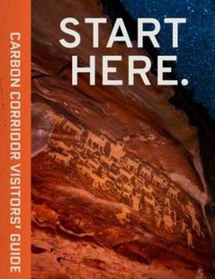
Carbon Corridor
Central UtahCradled by the Book Cliffs, this land boasts rich history reflected in ancient rock art, scenic and adventurous outdoor opportunities, and museums that educate about the region’s history. Request this Free Visitor GuideRequested!You're all set! Request a few more Visitor Guides, or complete the form below to receive your guides by mail.
Emery County, Utah South Central Utah
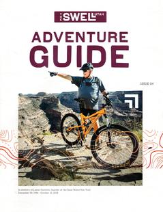
Emery County, Utah
South Central UtahWelcome to the Swell, a natural playground in the heart of Utah. Within the region, you will find endless opportunities to ride, climb, camp, hike or paddle. Request this Free Visitor GuideRequested!You're all set! Request a few more Visitor Guides, or complete the form below to receive your guides by mail.
Utah - Life Elevated Statewide
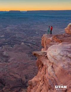
Utah - Life Elevated
StatewideWith five national parks and more than 40 state parks, Utah offers a wealth of outdoor activities for families & adventurers alike. Order your free Travel Guide today. Request this Free Visitor GuideRequested!You're all set! Request a few more Visitor Guides, or complete the form below to receive your guides by mail.
We also have the following visitor guides in Colorado. Click on any additional guides you would like to receive.
Chaffee County Central Colorado
Chaffee County
Central ColoradoMore than 100 miles of the Arkansas River and her tributaries flow through the heart of Chaffee County, gracing both Salida and Buena Vista with her beauty and world-renowned whitewater, fly-fishing, scenery and river festivals. Request this Free Visitor GuideRequested!You're all set! Request a few more Visitor Guides, or complete the form below to receive your guides by mail.
Colorado Springs Central Colorado
Colorado Springs
Central ColoradoFind yourself in Colorado Springs at Pikes Peak. We have five historic trains to transport you back to the days of cowboys and gold mining. Endless trails allow you to enjoy the abundant sunshine and spectacular scenery. A family vacation in Colorado Springs is the smart choice – great lodging values, a long list of low-cost or no-cost activities, and adventure around every corner. Order your free guide today. Request this Free Visitor GuideRequested!You're all set! Request a few more Visitor Guides, or complete the form below to receive your guides by mail.
Grand Lake Rocky Mountain National Park
Grand Lake
Rocky Mountain National ParkAt the edge of Rocky Mountain National Park, Grand Lake is the deepest natural lake in Colorado, dipping to 265 feet. Fed by high mountain runoff, the lake is clear and pristine. In the summer, you can rent a boat, bring your own or simply enjoy the gentle lapping of the waves from the sandy shore. Grand Lake connects with Shadow Mountain Lake via a canal, and just down the road is Lake Granby, the second largest body of water in Colorado. Request this Free Visitor GuideRequested!You're all set! Request a few more Visitor Guides, or complete the form below to receive your guides by mail.
Red River Northern New Mexico
Red River
Northern New MexicoRed River, New Mexico! A place where fresh powder winters meet refreshing summer days. Red River offers something for everyone with its convenient scenic location in the heart of Northern New Mexico’s Enchanted Circle. Red River is the place that awakens us each day by the soothing sound of a rushing river and then again each evening as the sun sets over main street. The mountain town of Red River is New Mexico True. Request this Free Visitor GuideRequested!You're all set! Request a few more Visitor Guides, or complete the form below to receive your guides by mail.
Farmington Northwestern New Mexico
Farmington
Northwestern New MexicoNorthwestern New Mexico is known by many as a magical place. Four Corners and the local Aztec Ruins are considered sacred ground for some and are fascinating to visit. Request this Free Visitor GuideRequested!You're all set! Request a few more Visitor Guides, or complete the form below to receive your guides by mail.
South Fork Southwestern Colorado
South Fork
Southwestern ColoradoAre you looking for a naturalist paradise with affordability? Then look no further South Fork is your destination. A world class golf course, gold medal fishing in the Rio Grande, and thousands of acres of National Forest to hike, bike, ATV, ski and snowmobile through. Request this Free Visitor GuideRequested!You're all set! Request a few more Visitor Guides, or complete the form below to receive your guides by mail.
Northwestern ColoradoWelcome to Colorado’s Great Northwest, Moffat County has nearly 2 million acres of public lands to explore. Experience places like Dinosaur National Monument, the Sand Wash Basin Wild Horse Management Area and free flowing rivers including the mighty Yampa, last of the wild ones! Request this Free Visitor GuideRequested!You're all set! Request a few more Visitor Guides, or complete the form below to receive your guides by mail.
We also have visitor guides available in states highlighted in blue below. Click on any state to see what's available.
Alaska
Arizona
California
Canada
Colorado
Hawaii
Idaho
Louisiana
Michigan
Montana
Nevada
New Mexico
Ohio
Oregon
Texas
Utah
Washington
Wyoming
Switch to Mobile Browser Mode
We offer a compact version of Go-Colorado for mobile users, allowing you to access just the information you need on the road. Of course, you can still use the full version of Go-Colorado on your mobile device just as you can on your desktop.


")