Colorado Map

Request Free Visitor Guides

Deschutes River - Bend to Lake Billy Chinook

Contact Info
813 S.W. Hwy, 97
Madras, OR 97741
Basics
Size:
30 miles
Elevation:
3500 feet

Description

Public ownership in this stretch of river is primarily a combination of BLM, USFS land, and three state parks. Most of the public land is included in the Deschutes River Recreation Area within the Crooked River National Grasslands, administered by the Ochoco National Forest. In some spots the river is wadable, and in other areas bank fishing is the rule. It is a preferred area for fly-fishing, this section is not open to bait fishing; however, lures are permitted. All fish in the river are wild, including rainbow trout up to 18 inches. Brown trout can be found in all sizes, including a few monsters pushing 8 pounds. Bull trout are present below Steelhead Falls, and profuse numbers of whitefish are available throughout the river. Crayfish are common. Boating is not possible due to low flows and frequent waterfalls farther downstream. The only navigable expanse is in the Deschutes Arm of Lake Billy Chinook.

From the north end of 1st Street in Bend down to the North Canal Dam, the river is accessible along the west bank, and fishing can be good when water levels are low in the summer. Deep pools and slow runs between rock-strewn stretches produce mostly small fish. In the winter, the river rushes over big boulders. During summer low flows, it swirls slowly past the same rocks. Water levels fluctuate greatly with the irrigation season. Fishing is best in between and around the boulders.

As the river leaves Bend, it passes the last man-made obstruction for 40 miles and becomes a wild, canyon river. More of the riverbanks are public land. Shorelines vary from flooded, marshy ground to blocky talus with some heavy vegetation of willow and alder. Around Lower Bridge, 25 miles below Bend cattails and sedges dominate. Springs below Lower Bridge help to stabilize water levels, as does inflow from Squaw Creek. The uplands are covered with juniper trees and bitterbrush, and the basalt canyon is of varying depth. Outstanding wild rainbow and brown trout habitat exist from Lower Bridge downstream 10 miles to Lake Billy Chinook. The deepest part of the canyon below Lower Bridge has excellent slots and pools and the best potential for a fishery if flows could be stabilized. Instream structure in the form of rocks, woody debris, and occasional weedbeds are plentiful throughout the canyon. The area is rich in wildlife.

The largest concentration of wild fish is from about a mile below Lower Bridge to Lake Billy Chinook. Steelhead Falls is about 5 miles below Lower Bridge. At Lake Billy Chinook, the Deschutes joins the Crooked and Metolius rivers.

Fishing

Fish:
Brown Trout
Bull Trout
Rainbow Trout
Whitefish
Fishing Methods:
Floating,Bank Fishing

Details

Size:
30 miles
Elevation:
3500 feet
1940 at Lake Billy Chinook
Camping Info
Tumalo State Park and Cline Falls State Park
Additional Details:

Bait/Lure Fishing Methods : Night crawlers, eggs, crayfish tails, flashy lures, spoons, and spinners. Benham Falls to Lake Billy Chinook are restricted to artificial flies and lures only.

Amenities

Map + Directions

Basic Directions

Sawyer Park in Bend, Cline Falls State Park, Highway 126 crossing the Deschutes River, Lower Bridge Rd. crossing of Deschutes River.

Most access is by trails from Steelhead Falls parking area and from the vehicle access's


Copyright © 1997 - 2024 The Go Travel Sites. All Rights Reserved and.

Email Page Link

Complete the form below to email this page to a friend or family member's email. You can send yourself an email as well. Your email and your recipient's email will NOT be shared with anyone. See our full Privacy Policy for details.
:
:
:


:
Copy Yourself on the Email Yes No
:
:

1

Select one or more Free Visitor Guides below

2

Complete the form to receive your guides by mail
Chaffee County Chaffee County Chaffee County
Central ColoradoMore than 100 miles of the Arkansas River and her tributaries flow through the heart of Chaffee County, gracing both Salida and Buena Vista with her beauty and world-renowned whitewater, fly-fishing, scenery and river festivals.
Request this Free Visitor GuideRequested! You're all set! Request a few more Visitor Guides, or complete the form below to receive your guides by mail.
Colorado Springs Colorado Springs Colorado Springs
Central ColoradoFind yourself in Colorado Springs at Pikes Peak. We have five historic trains to transport you back to the days of cowboys and gold mining. Endless trails allow you to enjoy the abundant sunshine and spectacular scenery. A family vacation in Colorado Springs is the smart choice – great lodging values, a long list of low-cost or no-cost activities, and adventure around every corner. Order your free guide today.
Request this Free Visitor GuideRequested! You're all set! Request a few more Visitor Guides, or complete the form below to receive your guides by mail.
Grand Lake Grand Lake Grand Lake
Rocky Mountain National ParkAt the edge of Rocky Mountain National Park, Grand Lake is the deepest natural lake in Colorado, dipping to 265 feet. Fed by high mountain runoff, the lake is clear and pristine. In the summer, you can rent a boat, bring your own or simply enjoy the gentle lapping of the waves from the sandy shore. Grand Lake connects with Shadow Mountain Lake via a canal, and just down the road is Lake Granby, the second largest body of water in Colorado.
Request this Free Visitor GuideRequested! You're all set! Request a few more Visitor Guides, or complete the form below to receive your guides by mail.
Red River Red River Red River
Northern New MexicoRed River, New Mexico! A place where fresh powder winters meet refreshing summer days. Red River offers something for everyone with its convenient scenic location in the heart of Northern New Mexico’s Enchanted Circle. Red River is the place that awakens us each day by the soothing sound of a rushing river and then again each evening as the sun sets over main street. The mountain town of Red River is New Mexico True.
Request this Free Visitor GuideRequested! You're all set! Request a few more Visitor Guides, or complete the form below to receive your guides by mail.
Farmington Farmington Farmington
Northwestern New MexicoNorthwestern New Mexico is known by many as a magical place. Four Corners and the local Aztec Ruins are considered sacred ground for some and are fascinating to visit.
Request this Free Visitor GuideRequested! You're all set! Request a few more Visitor Guides, or complete the form below to receive your guides by mail.
South Fork South Fork South Fork
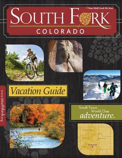
Southwestern ColoradoAre you looking for a naturalist paradise with affordability? Then look no further South Fork is your destination. A world class golf course, gold medal fishing in the Rio Grande, and thousands of acres of National Forest to hike, bike, ATV, ski and snowmobile through.
Request this Free Visitor GuideRequested! You're all set! Request a few more Visitor Guides, or complete the form below to receive your guides by mail.
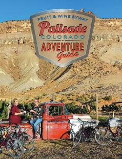
Palisade, Colorado Palisade, Colorado Palisade, Colorado
WesternLife Tastes Good Here all Year Long!
Request this Free Visitor GuideRequested! You're all set! Request a few more Visitor Guides, or complete the form below to receive your guides by mail.
Visit Moffat County Visit Moffat County Visit Moffat County
Northwestern ColoradoWelcome to Colorado’s Great Northwest, Moffat County has nearly 2 million acres of public lands to explore. Experience places like Dinosaur National Monument, the Sand Wash Basin Wild Horse Management Area and free flowing rivers including the mighty Yampa, last of the wild ones!
Request this Free Visitor GuideRequested! You're all set! Request a few more Visitor Guides, or complete the form below to receive your guides by mail.
Ski Utah Ski Utah Ski Utah
Utah
Request this Free Visitor GuideRequested! You're all set! Request a few more Visitor Guides, or complete the form below to receive your guides by mail.