Colorado Map

Request Free Visitor Guides

Cumberland Cultural Heritage Highway

Basics
Length:
197.5 miles (317 km)
Time:
3 days

Description

Traveling the Cumberland Cultural Heritage Highway is one way toexperience life away from the hustle and bustle of urban areas. Rurallandscapes, small towns, abundant lakes and rivers, and significanthistorical sites combine to make Cumberland Cultural Heritage Highwayan important part of Kentucky's byway system. Recreationalopportunities are never far away on the Cumberland Cultural HeritageHighway, which is a byway made up of different routes in SouthernKentucky.

Lake Cumberland, Dale Hollow Lake, and Green River Lake are thedominant lakes of the area, and they were originally constructed forflood control, but now they serve the public as state or resort parks.These lakes are removed from large urban areas to provide the visitorwith a sense of peacefulness. Remote and wild areas, such as the BigSouth Fork National River and Recreation Area and the Cumberland Riverdraw many visitors each year because of the excellent rafting, birding,camping, and fishing. High quality water and affordability make theselakes and the Kentucky State Park system popular sites in Kentucky.Superb fishing, powerboating, canoeing, and sailing are all availablealong the Cumberland Cultural Heritage Highway.

The Cumberland Cultural Heritage Highway is a now recreationalparadise due to its remote location and rural setting, but it was thisarea that became the site of migrations in the 1700s as settlers pushedwest for new, pristine land. They traveled through the Cumberland Gapinto Southern Kentucky and settled the area. The importance of theseearly settlers is not lost even today, as thousands of people come backto this area to trace the genealogy of their families. A uniqueculture, language patterns, architecture, clothing, and town planscreated an area which would see significant events such as Civil War battles, and an increase in mining and railroading.

Points of Interest

Points of Interest Along The Way

Battle of Mill Springs National Historic Landmark (KY)

This historic landmark is located on the northern bank of Lake Cumberland and is the site of a Civil War battle.

Directions

Northern bank of Lake Cumberland, KY

Big South Fork National Recreational and River Area (KY)

This wild national area provides an abundance of opportunities to experience outdoor activities along the Cumberland River and various trails in the area.

Directions

Daniel Boone National Forest. It crosses the KY/TN border.

Big South Fork Railroad (KY)

Historic downtown and scenic excursion train into Big South Fork.

Directions

KY

Blue Heron Mining Site (KY)

This National Park Service interpretive site focuses on life in a coal mining camp.

Directions

KY

Campbellsville (KY)

Campbellsville's historic downtown was established after the Revolutionary War, and it is also the site of Campbellsville University.

Directions

Campbellsville, KY

Columbia Town Center (KY)

The historic downtown center of Columbia with small shops, and nearby Lindsey Wilson College will be a charming break for the visitor.

Directions

Columbia, KY

Cumberland Falls (KY)

Cumberland Falls is the only moonbow falls in the western hemisphere.

Directions

Lake Cumberland State Resort Park, KY

Cumberland Falls State Park (KY)

This state resort park is adjacent to the National Forest and is located along the Cumberland River.

Directions

Located in the Daniel Boone National Forest off the KY90 and US27 junction traveling eastward.

Dale Hollow Resort Park (KY)

This southernmost state resort park is situated on the mysterious Dale Hollow Lake.

Directions

Located in southern KY; Dale Hollow Lake crosses into Tennessee

Green River Lake State Park (KY)

Green River Lake State Park offers great bicycling on its trail systems, as well as providing other recreational opportunities.

Directions

Between Campbellsville and Columbia east of KY55.

Details

Length:
197.5 miles (317 km)
Time:
3 days
Main Roads:
US-127 N

Map + Directions

Customizable Directions

Colorado Corbin/London SantaFeCounty-skyscraper

Copyright © 1997 - 2024 The Go Travel Sites. All Rights Reserved and.

Email Page Link

Complete the form below to email this page to a friend or family member's email. You can send yourself an email as well. Your email and your recipient's email will NOT be shared with anyone. See our full Privacy Policy for details.
:
:
:


:
Copy Yourself on the Email Yes No
:
:

1

Select one or more Free Visitor Guides below

2

Complete the form to receive your guides by mail
Chaffee County Chaffee County Chaffee County
Central ColoradoMore than 100 miles of the Arkansas River and her tributaries flow through the heart of Chaffee County, gracing both Salida and Buena Vista with her beauty and world-renowned whitewater, fly-fishing, scenery and river festivals.
Request this Free Visitor GuideRequested! You're all set! Request a few more Visitor Guides, or complete the form below to receive your guides by mail.
Colorado Springs Colorado Springs Colorado Springs
Central ColoradoFind yourself in Colorado Springs at Pikes Peak. We have five historic trains to transport you back to the days of cowboys and gold mining. Endless trails allow you to enjoy the abundant sunshine and spectacular scenery. A family vacation in Colorado Springs is the smart choice – great lodging values, a long list of low-cost or no-cost activities, and adventure around every corner. Order your free guide today.
Request this Free Visitor GuideRequested! You're all set! Request a few more Visitor Guides, or complete the form below to receive your guides by mail.
Grand Lake Grand Lake Grand Lake
Rocky Mountain National ParkAt the edge of Rocky Mountain National Park, Grand Lake is the deepest natural lake in Colorado, dipping to 265 feet. Fed by high mountain runoff, the lake is clear and pristine. In the summer, you can rent a boat, bring your own or simply enjoy the gentle lapping of the waves from the sandy shore. Grand Lake connects with Shadow Mountain Lake via a canal, and just down the road is Lake Granby, the second largest body of water in Colorado.
Request this Free Visitor GuideRequested! You're all set! Request a few more Visitor Guides, or complete the form below to receive your guides by mail.
Red River Red River Red River
Northern New MexicoRed River, New Mexico! A place where fresh powder winters meet refreshing summer days. Red River offers something for everyone with its convenient scenic location in the heart of Northern New Mexico’s Enchanted Circle. Red River is the place that awakens us each day by the soothing sound of a rushing river and then again each evening as the sun sets over main street. The mountain town of Red River is New Mexico True.
Request this Free Visitor GuideRequested! You're all set! Request a few more Visitor Guides, or complete the form below to receive your guides by mail.
Farmington Farmington Farmington
Northwestern New MexicoNorthwestern New Mexico is known by many as a magical place. Four Corners and the local Aztec Ruins are considered sacred ground for some and are fascinating to visit.
Request this Free Visitor GuideRequested! You're all set! Request a few more Visitor Guides, or complete the form below to receive your guides by mail.
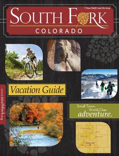
South Fork South Fork South Fork
Southwestern ColoradoAre you looking for a naturalist paradise with affordability? Then look no further South Fork is your destination. A world class golf course, gold medal fishing in the Rio Grande, and thousands of acres of National Forest to hike, bike, ATV, ski and snowmobile through.
Request this Free Visitor GuideRequested! You're all set! Request a few more Visitor Guides, or complete the form below to receive your guides by mail.
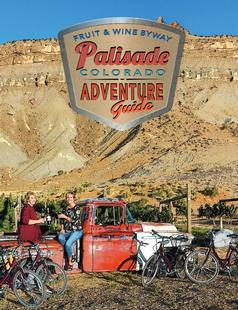
Palisade, Colorado Palisade, Colorado Palisade, Colorado
WesternLife Tastes Good Here all Year Long!
Request this Free Visitor GuideRequested! You're all set! Request a few more Visitor Guides, or complete the form below to receive your guides by mail.
Visit Moffat County Visit Moffat County Visit Moffat County
Northwestern ColoradoWelcome to Colorado’s Great Northwest, Moffat County has nearly 2 million acres of public lands to explore. Experience places like Dinosaur National Monument, the Sand Wash Basin Wild Horse Management Area and free flowing rivers including the mighty Yampa, last of the wild ones!
Request this Free Visitor GuideRequested! You're all set! Request a few more Visitor Guides, or complete the form below to receive your guides by mail.
Ski Utah Ski Utah Ski Utah
Utah
Request this Free Visitor GuideRequested! You're all set! Request a few more Visitor Guides, or complete the form below to receive your guides by mail.