Colorado Map

Request Free Visitor Guides

Bradenton Beach Scenic Highway

Basics
Length:
2.8 miles (4 km)
Time:
30 minutes

Description

This scenic shoreline byway starts at the south end of the seven-mile Anna Maria Island and ends 2.8 miles to the north in historic Bradenton Beach. Gulf Drive, as the natives call the throughway, offers its travelers fine views of the Gulf of Mexico, Sarasota Bay, and Coquina Beach. Swimming, sunbathing, wildlife viewing, and picnicking are just some of the recreational opportunities provided along the route. The byway intersects Bridge Street in Bradenton Beach, which continues to historic Bridge Street Pier. The pier is famous along the Intercoastal Waterway for its fishing, dining, and strolling.

Tourism Resources

Points of Interest

Points of Interest Along The Way

Anna Maria City (FL)

Anna Maria Island's first settler homesteaded much of what is now the City of Anna Maria.

Directions

On the North end of Anna Maria Island

Anna Maria Island Historical Museum (FL)

Anna Maria Island Historical Museum offers a look at the early history of Anna Maria Island through books, pictures, artifacts, and maps.

Directions

402 Pine Avenue Anna Maria, FL 34216

Bradenton City (FL)

Bradenton lies south of Tampa Bay area and is a wonderful get-away with plenty of golfing, fishing, shopping, and historical attractions.

Directions

Bradenton City lies just across Palma Sola Bay.

City of Bradenton Beach (FL)

For decades, the City of Bradenton Beach served as the hub of activity on Anna Maria Island. From 1922 until the late-fifties, Cortez Bridge extending from Bradenton Beach was the only Bridge to the mainland.

There are many aquatic activities to participate in: swimming, sailing, jet skiing, parasailing, or fishing. If your desire is to just relax, you can take a barefoot walk in the white sand along the beaches.

Directions

The North end of the Bradenton Beach Scenic Byway.

Coquina Baywalk at Leffis Key (FL)

The Coquina Baywalk on Leffis Key is a park owned by Manatee County. The tiny peninsula, just across the street from Coquina beach on Anna Maria Island, has undergone much restoration over the years. Now the walkways of the Coquina Baywalk surround 30 acres of vegetaiton and wildlife, offering visitors the chance to view this natural habitat up close.

Directions

On Leffis key on the east side of the Bradenton Beach Scenic Highway.

Coquina Beach (FL)

Coquina Beach is one of the largest beaches in the area. The beach is located on the south end of Anna Maria Island. Some amenities include,free parking, lifeguards, concessions, picnic tables, a playground, restrooms and showers. A boat launching point is just across the street from the beach.

Directions

Just off of the west side of the Bradenton Beach Scenic Byway.

De Soto National Memorial (FL)

De Soto National Memorial commemorates Spanish explorer Hernando de Soto. De Soto and his army of 600 soldiers landed on the southwest Florida coast in 1539. De Soto intended to explore and colonize "La Florida," and obtain riches for the King of Spain. De Soto was never able to establish a permanent colony in Florida before his death four years later.

Directions

Approximately forty miles north east of Bradenton Beach.

Historic Bridge Street Pier (FL)

The Bridge Street Pier is the last remaining piece of the historic bridge that first connected Bradenton Beach to the mainland. The Bradenton Beach fishing pier is the western end of that bridge.

Directions

At the eastern end of Bridge Street in Bradenton Beach.

Holmes Beach (FL)

Holmes Beach is located in the middle of Anna Maria Island, andis the largest of the three cities on the island. One of two mainaccess bridges comes from Florida's West Coast to Holmes Beach.Many of the island's fine restaraunts, lodgings and shoppingcenters are found in the city.

Directions

About 2 miles north of Bradenton Beach City.

Details

Length:
2.8 miles (4 km)
Time:
30 minutes
Main Roads:
Gulf Dr N and Gulf Dr S

Map + Directions

Customizable Directions

Colorado Sarasota SantaFeCounty-skyscraper

Copyright © 1997 - 2024 The Go Travel Sites. All Rights Reserved and.

Email Page Link

Complete the form below to email this page to a friend or family member's email. You can send yourself an email as well. Your email and your recipient's email will NOT be shared with anyone. See our full Privacy Policy for details.
:
:
:


:
Copy Yourself on the Email Yes No
:
:

1

Select one or more Free Visitor Guides below

2

Complete the form to receive your guides by mail
Chaffee County Chaffee County Chaffee County
Central ColoradoMore than 100 miles of the Arkansas River and her tributaries flow through the heart of Chaffee County, gracing both Salida and Buena Vista with her beauty and world-renowned whitewater, fly-fishing, scenery and river festivals.
Request this Free Visitor GuideRequested! You're all set! Request a few more Visitor Guides, or complete the form below to receive your guides by mail.
Colorado Springs Colorado Springs Colorado Springs
Central ColoradoFind yourself in Colorado Springs at Pikes Peak. We have five historic trains to transport you back to the days of cowboys and gold mining. Endless trails allow you to enjoy the abundant sunshine and spectacular scenery. A family vacation in Colorado Springs is the smart choice – great lodging values, a long list of low-cost or no-cost activities, and adventure around every corner. Order your free guide today.
Request this Free Visitor GuideRequested! You're all set! Request a few more Visitor Guides, or complete the form below to receive your guides by mail.
Grand Lake Grand Lake Grand Lake
Rocky Mountain National ParkAt the edge of Rocky Mountain National Park, Grand Lake is the deepest natural lake in Colorado, dipping to 265 feet. Fed by high mountain runoff, the lake is clear and pristine. In the summer, you can rent a boat, bring your own or simply enjoy the gentle lapping of the waves from the sandy shore. Grand Lake connects with Shadow Mountain Lake via a canal, and just down the road is Lake Granby, the second largest body of water in Colorado.
Request this Free Visitor GuideRequested! You're all set! Request a few more Visitor Guides, or complete the form below to receive your guides by mail.
Red River Red River Red River
Northern New MexicoRed River, New Mexico! A place where fresh powder winters meet refreshing summer days. Red River offers something for everyone with its convenient scenic location in the heart of Northern New Mexico’s Enchanted Circle. Red River is the place that awakens us each day by the soothing sound of a rushing river and then again each evening as the sun sets over main street. The mountain town of Red River is New Mexico True.
Request this Free Visitor GuideRequested! You're all set! Request a few more Visitor Guides, or complete the form below to receive your guides by mail.
Farmington Farmington Farmington
Northwestern New MexicoNorthwestern New Mexico is known by many as a magical place. Four Corners and the local Aztec Ruins are considered sacred ground for some and are fascinating to visit.
Request this Free Visitor GuideRequested! You're all set! Request a few more Visitor Guides, or complete the form below to receive your guides by mail.
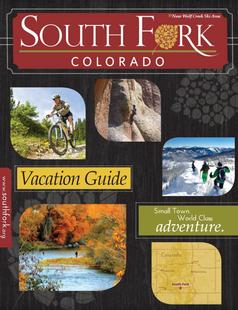
South Fork South Fork South Fork
Southwestern ColoradoAre you looking for a naturalist paradise with affordability? Then look no further South Fork is your destination. A world class golf course, gold medal fishing in the Rio Grande, and thousands of acres of National Forest to hike, bike, ATV, ski and snowmobile through.
Request this Free Visitor GuideRequested! You're all set! Request a few more Visitor Guides, or complete the form below to receive your guides by mail.
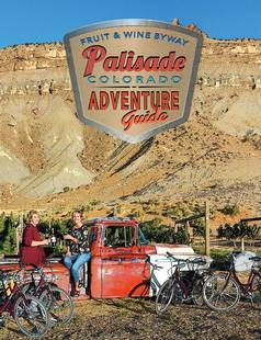
Palisade, Colorado Palisade, Colorado Palisade, Colorado
WesternLife Tastes Good Here all Year Long!
Request this Free Visitor GuideRequested! You're all set! Request a few more Visitor Guides, or complete the form below to receive your guides by mail.
Visit Moffat County Visit Moffat County Visit Moffat County
Northwestern ColoradoWelcome to Colorado’s Great Northwest, Moffat County has nearly 2 million acres of public lands to explore. Experience places like Dinosaur National Monument, the Sand Wash Basin Wild Horse Management Area and free flowing rivers including the mighty Yampa, last of the wild ones!
Request this Free Visitor GuideRequested! You're all set! Request a few more Visitor Guides, or complete the form below to receive your guides by mail.
Ski Utah Ski Utah Ski Utah
Utah
Request this Free Visitor GuideRequested! You're all set! Request a few more Visitor Guides, or complete the form below to receive your guides by mail.