Colorado Map

Request Free Visitor Guides

Boy River

Contact Info
Chippewa National Forest
201 Minnesota Ave. East
Walker, MN 56484

Phone:
218-547-1044

Description

The Boy River canoe tour follows the lower part of the Boy River drainage which starts at Ten Mile Lake south of Walker and flows southeast and then north through Woman Lake. Here I Enters the Chippewa National Forest. From this point, the river flows through Boy Lake and on to Boy Bay of Leech Lake, which turns and flows into the Mississippi River through the Leech Lake River.

The portion of the river included in this tour is well suited for canoe travel. The views on the river are broad and expansive, especially through the lakes. The water depth is fairly constant throughout the year and the rate of travel depends upon the individual. The best time of year to travel is mid-May to July, avoiding spring’s cold water temperatures and fall’s thick, tall wild rice that can inhibit visibility. There are no portages and the route can be traveled in one day. There is one stretch of faster flowing water called riffles (less than Class I rapids). As you travel north, the river bed widens into sedge meadow and into large beds of wild rice.

We do not recommend travel beyond the terminus shown downstream from the town of Boy River except for exploratory trips terminating short of Leech Lake. The river spreads into wide swamps with no high land accessible. The condition continues well into Leech Lake where no landing is available until Sugar or Blackduck Point. Leech Lake can become extremely rough in a short time. Use caution when journeying into these large waters

Details

Additional Details:

As you travel the river and lakes of the Boy River Canoe Tour, take time to notice the changes in the Forest. You will be paddling by three very different forest types, including lowland conifer, upland hardwood and sedge meadow. Though the route is mainly a slow, meandering river, it does have many lake-like characteristics. The prime time to travel is mid-May to July. Access points are marked on the map, along with the three stopover areas where you may want to take a break or set up camp.


History

Long before the first European trapper or explorer ventured along the drainage leading to the Mississippi River, prehistoric and historic tribes were living along the shores. He rivers and lakes provided a major food source as well as a convenient route of travel. Dakota and Anishinabeg flourished here. During the first half of the 18th century, the Anishinabeg people of northern Minnesota named these waters “Equademog,” which meant “edge of the slope.” With the passage of time, the name of the area changed to Inguadona.


POINTS OF INTEREST
The variety of forest types along the Boy River makes this route a wildlife viewing area rather than a fishing river. Herons, wood ducks, mergansers, teal and other waterfowl are seen along with an occasional otter! Bald eagles feed and perch along the riverway. When you see an eagle, please respect them and move quickly and quietly by. Disturbances can disrupt nesting pairs.
  • State of Minnesota (DNR) public access on Inguadona Lake. This is the first access point on the route.
  • Campsite located on the east side of the river, this has a wilderness latrine and fire grate available for campers. The river can be accessed here. However it is easier to put in on Highway 200.
  • State of Minnesota public access on Highway 200. Parking spots are available on each side of the river.
  • National Forest public canoe access. Parking is limited, park on north side of County Road 53, where it is drier.
  • Campsite located on east side of river, this has a wilderness latrine and fire grate available for campers.
  • National Forest public access on the south side of the river, this has a wilderness latrine and fire grate available for campers. This is the last place to exit the river before entering Leech Lake

Amenities

Map + Directions

Colorado Chippewa National Forest ChaffeeCounty-skyscraper

Copyright © 1997 - 2024 The Go Travel Sites. All Rights Reserved and.

Email Page Link

Complete the form below to email this page to a friend or family member's email. You can send yourself an email as well. Your email and your recipient's email will NOT be shared with anyone. See our full Privacy Policy for details.
:
:
:


:
Copy Yourself on the Email Yes No
:
:

1

Select one or more Free Visitor Guides below

2

Complete the form to receive your guides by mail
Chaffee County Chaffee County Chaffee County
Central ColoradoMore than 100 miles of the Arkansas River and her tributaries flow through the heart of Chaffee County, gracing both Salida and Buena Vista with her beauty and world-renowned whitewater, fly-fishing, scenery and river festivals.
Request this Free Visitor GuideRequested! You're all set! Request a few more Visitor Guides, or complete the form below to receive your guides by mail.
Colorado Springs Colorado Springs Colorado Springs
Central ColoradoFind yourself in Colorado Springs at Pikes Peak. We have five historic trains to transport you back to the days of cowboys and gold mining. Endless trails allow you to enjoy the abundant sunshine and spectacular scenery. A family vacation in Colorado Springs is the smart choice – great lodging values, a long list of low-cost or no-cost activities, and adventure around every corner. Order your free guide today.
Request this Free Visitor GuideRequested! You're all set! Request a few more Visitor Guides, or complete the form below to receive your guides by mail.
Grand Lake Grand Lake Grand Lake
Rocky Mountain National ParkAt the edge of Rocky Mountain National Park, Grand Lake is the deepest natural lake in Colorado, dipping to 265 feet. Fed by high mountain runoff, the lake is clear and pristine. In the summer, you can rent a boat, bring your own or simply enjoy the gentle lapping of the waves from the sandy shore. Grand Lake connects with Shadow Mountain Lake via a canal, and just down the road is Lake Granby, the second largest body of water in Colorado.
Request this Free Visitor GuideRequested! You're all set! Request a few more Visitor Guides, or complete the form below to receive your guides by mail.
Red River Red River Red River
Northern New MexicoRed River, New Mexico! A place where fresh powder winters meet refreshing summer days. Red River offers something for everyone with its convenient scenic location in the heart of Northern New Mexico’s Enchanted Circle. Red River is the place that awakens us each day by the soothing sound of a rushing river and then again each evening as the sun sets over main street. The mountain town of Red River is New Mexico True.
Request this Free Visitor GuideRequested! You're all set! Request a few more Visitor Guides, or complete the form below to receive your guides by mail.
Farmington Farmington Farmington
Northwestern New MexicoNorthwestern New Mexico is known by many as a magical place. Four Corners and the local Aztec Ruins are considered sacred ground for some and are fascinating to visit.
Request this Free Visitor GuideRequested! You're all set! Request a few more Visitor Guides, or complete the form below to receive your guides by mail.
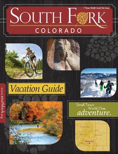
South Fork South Fork South Fork
Southwestern ColoradoAre you looking for a naturalist paradise with affordability? Then look no further South Fork is your destination. A world class golf course, gold medal fishing in the Rio Grande, and thousands of acres of National Forest to hike, bike, ATV, ski and snowmobile through.
Request this Free Visitor GuideRequested! You're all set! Request a few more Visitor Guides, or complete the form below to receive your guides by mail.
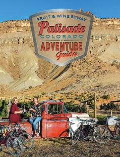
Palisade, Colorado Palisade, Colorado Palisade, Colorado
WesternLife Tastes Good Here all Year Long!
Request this Free Visitor GuideRequested! You're all set! Request a few more Visitor Guides, or complete the form below to receive your guides by mail.
Visit Moffat County Visit Moffat County Visit Moffat County
Northwestern ColoradoWelcome to Colorado’s Great Northwest, Moffat County has nearly 2 million acres of public lands to explore. Experience places like Dinosaur National Monument, the Sand Wash Basin Wild Horse Management Area and free flowing rivers including the mighty Yampa, last of the wild ones!
Request this Free Visitor GuideRequested! You're all set! Request a few more Visitor Guides, or complete the form below to receive your guides by mail.
Ski Utah Ski Utah Ski Utah
Utah
Request this Free Visitor GuideRequested! You're all set! Request a few more Visitor Guides, or complete the form below to receive your guides by mail.