Colorado Map

Request Free Visitor Guides

Apple Orchard Falls & Cornelius Creek Loop Trail

Contact Info
Natural Bridge Station, VA 24579

Phone:
540-291-2188

Description

This trail lies within an 1825 acre Special Management Area (SMA). To become an SMA, an area must possess unique values requiring special management. For this particular area that means only basic maintenance of the trail and the seeded wildlife strip – and no cutting of timber! The Forest Service is protecting and preserving these old growth forests and wildlife and recreation.

Details

Additional Details:

Neo-tropical migratory songbirds are the featured species in this area. These are birds that spend winters in Central and South America and spend the warmer months here on the Forest. Bird watchers shoud look for the Scarlet Tanger, Red-eyed Vireo and Ovenbird among other old growth forest dwellers. This area also provides a protected habitat for the rare Peaks of Otter Salamander. Deer, Bear, Turkey and other game thrive here, as do the native trout that live in North Creek and its tributaries. Hunters and fishers may enjoy this area as well as hikers but need to be familiar with seasons and regulations.

This tract was originally owned and logged by the Virginia Lumber and Extract Company. The lower part of the Trail follows old logging roads, which were used until the Forest Service acquired the property in 1917. The Trail was originally constructed by the Civilian Conservation Corps and later reconstructed by the Young Conservation Corps (YCC) in 1982. Some relocation of the lower end of the trail and basic maintenance was done in 1994 by the YCC and the students of the Natural Bridge Learning Center under the supervision of the Forest Service.

This tract was originally owned and logged by the Virginia Lumber and Extract Company. The lower part of the Trail follows old logging roads, which were used until the Forest Service acquired the property in 1917. The Trail was originally constructed by the Civilian Conservation Corps and later reconstructed by the Young Conservation Corps (YCC) in 1982. Some relocation of the lower end of the trail and basic maintenance was done in 1994 by the YCC and the students of the Natural Bridge Learning Center under the supervision of the Forest Service.

The trail begins at an elevation of 3500 feet at the sunset Field Overlook near milepost 78. It leads northwest, crossing into the Jefferson National Forest at 0.1 mile, crossing the Appalachian Trail at 0.2 mile and a seeded logging road at 0.8 mile. At 1.1 miles the trail passes a huge overhanging rock on the right what would give shelter from the rain. It begins a steep descent around the falls at 1.2 miles. At 1.4 miles look back for a beautiful view of the 200 ft high falls. The trail leads into the headwaters of North Creek. At 3.4 miles, the Northwest end of the trail joins FS Road 59 at the head of Cornelius Creek Trail.

The trail begins at an elevation of 3500 feet at the sunset Field Overlook near milepost 78. It leads northwest, crossing into the Jefferson National Forest at 0.1 mile, crossing the Appalachian Trail at 0.2 mile and a seeded logging road at 0.8 mile. At 1.1 miles the trail passes a huge overhanging rock on the right what would give shelter from the rain. It begins a steep descent around the falls at 1.2 miles. At 1.4 miles look back for a beautiful view of the 200 ft high falls. The trail leads into the headwaters of North Creek. At 3.4 miles, the Northwest end of the trail joins FS Road 59 at the head of Cornelius Creek Trail.

Apple Tree Road (FS 3034) ends about 100 feet from the trail and provides a point of access about .75 mile below the Falls. To reach FS 3034, take Va. 130 at Natural Bridge to Va. 759. Turn right on Va. 759, follow for 3.1 miles to Va. 781 (Cave Mountain Lake Road). Turn right on Va. 781; follow for 2.8 miles to Va. 812. Turn left on Va. 812, follow for 7.3 miles. Turn right on FS 3034 and park at the end of the road (2.1 miles).

Apple Orchard Falls Trail and Cornelius Creek Trail offer several different options for use as a loop trail. The hiker may begin either at Sunset Field Overlook on the Parkway or at the end of FS 59, but the recommended hike begins at the end of FS 59 on Cornelius Creek Trail. This trail offers a gentler ascent than the Apple Orchard Falls Trail. The loop may be joined either by the Appalachian Trail (about 6 to 7 hrs) or by the seeded logging road (about 5 hrs.).

Map + Directions


Copyright © 1997 - 2024 The Go Travel Sites. All Rights Reserved and.

Email Page Link

Complete the form below to email this page to a friend or family member's email. You can send yourself an email as well. Your email and your recipient's email will NOT be shared with anyone. See our full Privacy Policy for details.
:
:
:


:
Copy Yourself on the Email Yes No
:
:

1

Select one or more Free Visitor Guides below

2

Complete the form to receive your guides by mail
Chaffee County Chaffee County Chaffee County
Central ColoradoMore than 100 miles of the Arkansas River and her tributaries flow through the heart of Chaffee County, gracing both Salida and Buena Vista with her beauty and world-renowned whitewater, fly-fishing, scenery and river festivals.
Request this Free Visitor GuideRequested! You're all set! Request a few more Visitor Guides, or complete the form below to receive your guides by mail.
Colorado Springs Colorado Springs Colorado Springs
Central ColoradoFind yourself in Colorado Springs at Pikes Peak. We have five historic trains to transport you back to the days of cowboys and gold mining. Endless trails allow you to enjoy the abundant sunshine and spectacular scenery. A family vacation in Colorado Springs is the smart choice – great lodging values, a long list of low-cost or no-cost activities, and adventure around every corner. Order your free guide today.
Request this Free Visitor GuideRequested! You're all set! Request a few more Visitor Guides, or complete the form below to receive your guides by mail.
Grand Lake Grand Lake Grand Lake
Rocky Mountain National ParkAt the edge of Rocky Mountain National Park, Grand Lake is the deepest natural lake in Colorado, dipping to 265 feet. Fed by high mountain runoff, the lake is clear and pristine. In the summer, you can rent a boat, bring your own or simply enjoy the gentle lapping of the waves from the sandy shore. Grand Lake connects with Shadow Mountain Lake via a canal, and just down the road is Lake Granby, the second largest body of water in Colorado.
Request this Free Visitor GuideRequested! You're all set! Request a few more Visitor Guides, or complete the form below to receive your guides by mail.
Red River Red River Red River
Northern New MexicoRed River, New Mexico! A place where fresh powder winters meet refreshing summer days. Red River offers something for everyone with its convenient scenic location in the heart of Northern New Mexico’s Enchanted Circle. Red River is the place that awakens us each day by the soothing sound of a rushing river and then again each evening as the sun sets over main street. The mountain town of Red River is New Mexico True.
Request this Free Visitor GuideRequested! You're all set! Request a few more Visitor Guides, or complete the form below to receive your guides by mail.
Farmington Farmington Farmington
Northwestern New MexicoNorthwestern New Mexico is known by many as a magical place. Four Corners and the local Aztec Ruins are considered sacred ground for some and are fascinating to visit.
Request this Free Visitor GuideRequested! You're all set! Request a few more Visitor Guides, or complete the form below to receive your guides by mail.
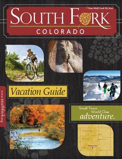
South Fork South Fork South Fork
Southwestern ColoradoAre you looking for a naturalist paradise with affordability? Then look no further South Fork is your destination. A world class golf course, gold medal fishing in the Rio Grande, and thousands of acres of National Forest to hike, bike, ATV, ski and snowmobile through.
Request this Free Visitor GuideRequested! You're all set! Request a few more Visitor Guides, or complete the form below to receive your guides by mail.
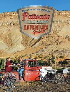
Palisade, Colorado Palisade, Colorado Palisade, Colorado
WesternLife Tastes Good Here all Year Long!
Request this Free Visitor GuideRequested! You're all set! Request a few more Visitor Guides, or complete the form below to receive your guides by mail.
Visit Moffat County Visit Moffat County Visit Moffat County
Northwestern ColoradoWelcome to Colorado’s Great Northwest, Moffat County has nearly 2 million acres of public lands to explore. Experience places like Dinosaur National Monument, the Sand Wash Basin Wild Horse Management Area and free flowing rivers including the mighty Yampa, last of the wild ones!
Request this Free Visitor GuideRequested! You're all set! Request a few more Visitor Guides, or complete the form below to receive your guides by mail.
Ski Utah Ski Utah Ski Utah
Utah
Request this Free Visitor GuideRequested! You're all set! Request a few more Visitor Guides, or complete the form below to receive your guides by mail.