


Basics
- Location:
- Near Steamboat Springs
- Setting:
- Mountainous
- Length:
- 12.2 mile roundtrip
- Difficulty:
- Intermediate
- Time:
- 6 to 7 hours
- Trailhead Elevation:
- 8500 feet
- Elevation Change:
- 1400 feet
- Season:
- Spring - Fall
Description
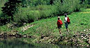
Gilpin Lake, named for Governor William Gilpin, is one of the most popular destinations within the Mount Zirkel wilderness. It offers a 29 acre, deep, blue alpine lake of magnificent beauty and views of the nearby Sawtooth Range. Heavily shaded, the trail winds through thick forests of conifer trees, wildflower meadows and avalanche paths following Gilpin Creek most of the way up to the lake.
NOTE: This road was affected by the Routt Divide Blowdown and is not open past Coyote Park as of 06/99. Users have to park in Coyote Park and walk in two miles on the road to get to the Slavonia trailhead. Due to the popularity and easy accessibility of this trail, this area receives some of the highest use of any area in this wilderness. This trail is not suggested if you are seeking solitude. Gilpin, Gold Creek and Three Island Lake trails are the most heavily used areas on the district. If seeking solitude, please refer to trails less heavily traveled. Overuse and abuse have led to implementing special regulations in hopes for revegetation. Regulations prohibit camping within 1/4 mile of the lake. Please camp elsewhere using low impact techniques or visit Gilpin Lake on day hikes.
Once you have started up the trail, it will quickly fork; stay left to continue towards Gilpin Lake. Continuing with the 1161 trail, you will enter the Mount Zirkel Wilderness after 1.6 miles (from the trailhead). Once you reach the lake, the trail continues up and over the saddle behind the lake, dropping down to connect with the Gold Creek Lake Trail #1150. If you continue right (downhill) on the 1150 this will take you back to the Slavonia trailhead completing a 9 mile loop.
Tour Companies
Vista Verde Guest Ranch - Hiking
- Near Steamboat Springs
- Hiking
- 970-879-3858
 At Vista Verde Ranch, hiking is one of the many activities you can try during your all-inclusive Colorado ranch vacation. Our guides offer a customized outdoor experience whether you want to rock climb, mountain bike, fly fish or horseback ride.
Helpful Links
Tour Companies
Vista Verde Guest Ranch - Hiking
- Near Steamboat Springs
- Hiking
- 970-879-3858
Details
Location:
Setting:
Length:
Difficulty:
Time:
Trailhead Elevation:
Elevation Change:
Season:
Useful Map(s):
Map + Directions
Basic Directions
Drive west out of Steamboat Springs on Hwy. 40 approximately 2 miles and turn right on Elk River Road (County Road 129). Follow CR 129 about 18 miles to the Seedhouse Road (Forest Development Road 400; also CR 64) and turn right. Continue for about 10 miles to the end at the Slavonia trailhead parking.


