


Contact Info
Medicine Bow - Routt National Forests
300 Roselawn Ave.
PO Box 7
Yampa, CO 80483
300 Roselawn Ave.
PO Box 7
Yampa, CO 80483
- Phone:
- 970-638-4516
Basics
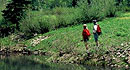
- Length:
- 8 miles
- Difficulty:
- Easy
- Time:
- 2.5 - 3.5 hours
- Trailhead Elevation:
- 9280 feet
- Elevation Range:
- 8960 feet to 9280 feet
- Elevation Change:
- -320 feet
- Season:
- June to November
Helpful Links
Tour Companies
Vista Verde Guest Ranch - Hiking
- Near Steamboat Springs
- Hiking
- 970-879-3858
 At Vista Verde Ranch, hiking is one of the many activities you can try during your all-inclusive Colorado ranch vacation. Our guides offer a customized outdoor experience whether you want to rock climb, mountain bike, fly fish or horseback ride.
Details
Length:
8 miles
Difficulty:
Easy
Time:
2.5 - 3.5 hours
Trailhead Elevation:
9280
Elevation Range:
8960 feet to 9280
Elevation Change:
-320
Season:
June to November
Useful Map(s):
USGS: Routt NF, Yampa Ranger District, or Dunckley Pass Quads.


