


Basics
- Location:
- Steamboat Lake State Park, 30 miles north of Steamboat Springs
- Length:
- 16 mile roundtrip
- Difficulty:
- Intermediate
- Time:
- 8 to 9.5 hours
- Trailhead Elevation:
- 8100 feet
- Season:
- Winter Only
Basic Directions
Steamboat Lake State Park
From Steamboat Springs go west two miles on U.S. 40 to County Road 129. Turn north and drive 26 miles.
Description
Trail provides excellent access for winter trails on National Forest Land. Parking is provided at the Marina parking lot. Please be aware of and respect the non-motorized trail area between parking lot and Visitor Center.
Permitted uses: Skis, snowshoe and snowmobile
ADA accessible: No
Pets: Yes
Tour Companies
Vista Verde Guest Ranch - Hiking
- Near Steamboat Springs
- Hiking
- 970-879-3858
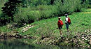 At Vista Verde Ranch, hiking is one of the many activities you can try during your all-inclusive Colorado ranch vacation. Our guides offer a customized outdoor experience whether you want to rock climb, mountain bike, fly fish or horseback ride.
Helpful Links
Tour Companies
Vista Verde Guest Ranch - Hiking
- Near Steamboat Springs
- Hiking
- 970-879-3858
Details
Location:
Steamboat Lake State Park, 30 miles north of Steamboat Springs
Length:
16 mile roundtrip
Difficulty:
Intermediate
Time:
8 to 9.5 hours
Trailhead Elevation:
8100
Season:
Winter Only


