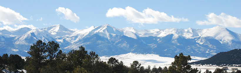


The Sangre de Cristo Mountains in south central Colorado are a narrow, steep range geologically different from the surrounding Rockies. Several of the country's most challenging peaks, including the jagged Crestone Needle, lie within the range. Elk herds and bighorn sheep make their home in the area, and the lack of developed attractions makes it easy to find peace and solitude.
The full Sangre de Cristo range extends south into New Mexico and is one of the longest mountain chains in the country. Colorado's section is protected in the Sangre de Cristo Wilderness Area, a quarter-of-a-million acre region containing dozens of trails. Near the New Mexico border are a few ski resorts. Great Sand Dunes National Park is up against the range's western slope.
The Sangre de Cristo range begins about 75 miles southwest of Colorado Springs. CO Hwy 69 parallels the range on the east side, and US Highways 285 and 160 go around the Colorado portion of the range on its north and south ends, respectively.