


Basics
- Location:
- Near Steamboat Springs
- Setting:
- Mountainous
- Length:
- 15.2 mile roundtrip
- Time:
- 8 to 9 hours
- Trailhead Elevation:
- 7400 feet
- Elevation Change:
- 2600 feet
- Season:
- Late Spring - Early Winter
Basic Directions
1)Go east of Steamboat Springs 3 miles on Fish Creek Road to Fish Creek Falls Parking Area. Two parking lots are provided. The lower lot is for overnight and horse trailers and the upper lot is for day hiking and picnicking parking. Both lots require a $3 fee per vehicle. Please use the envelopes that are provided.
2)On U.S. 40, go southeast of Steamboat Springs about 21 miles to the Dumont Lake turn-off. Follow the old highway to Forest Road #311 at the stone monument. Parking is provided here or the unimproved road continues to Base Camp where 1101 begins. Travel 1101 to the junction with 1102, 3.3 miles. Road #311 is not suggested for passenger cars or trailers.
Description
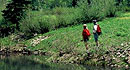
The Fish Creek Falls is one of the most popular attractions of the Steamboat Springs area. Its close proximity to town and the spectacular falls attract large numbers of visitors. A picnic ground and interpretive signing add to the attraction. However, as the trail climbs in elevation above the falls, fewer people are encountered. The area near the Continental Divide offers access to several lakes and many subalpine meadows making it an attractive area for backpack camping.
The first section of trail from Fish Creek Falls Parking Area is wide and smooth providing easy access to the falls viewing area. After crossing the creek, the trail climbs steeply up Fish Creek Canyon. After recrossing the creek it continues up the canyon towards Long Lake. Just before reaching Long Lake, trail 1032 (Mountain View Trail) takes off on the users' right. Many mountain bikers will join this trail which takes them to Storm Peak, instead of the high-use area of Fish Creek Falls. Passing trail 1032, continue east to Long Lake and further east to the Continental Divide, Wyoming Trail #1101. At this point the Fish Creek Falls National Scenic Trail #1102 ends. However, this junction offers many different exit areas if the user wishes. Also many uses change. Please refer to the Routt National Forest map for motorized and mechanized trail information.
Tour Companies
Vista Verde Guest Ranch - Hiking
- Near Steamboat Springs
- Hiking
- 970-879-3858
 At Vista Verde Ranch, hiking is one of the many activities you can try during your all-inclusive Colorado ranch vacation. Our guides offer a customized outdoor experience whether you want to rock climb, mountain bike, fly fish or horseback ride.
Helpful Links
Tour Companies
Vista Verde Guest Ranch - Hiking
- Near Steamboat Springs
- Hiking
- 970-879-3858


